Image

UNECE Countries in Figures 2015
This publication gives a snapshot of the social and economic conditions in each of the member States, using statistical indicators from a wide variety of different domains, ranging from GDP per capita...
This publication gives a snapshot of the social and economic conditions in each of the member States, using statistical indicators from a wide variety of different domains, ranging from GDP per capita...
UNECE Countries in Figures 2013
This publication gives a snapshot of the social and economic conditions in each of the member States, using statistical indicators from a wide variety of different domains, ranging from GDP per capita...
This publication gives a snapshot of the social and economic conditions in each of the member States, using statistical indicators from a wide variety of different domains, ranging from GDP per capita...
Global International Waters Assessment
Caspian Sea
This report presents the GIWA assessment of the Caspian Sea – the largest land-locked water body on earth, bordered by five countries and influenced by three more in the catchment area. The assessment...
This report presents the GIWA assessment of the Caspian Sea – the largest land-locked water body on earth, bordered by five countries and influenced by three more in the catchment area. The assessment...
Global International Waters Assessment
Sea of Okhotsk
This report presents the results of the GIWA assessment of the Sea of Okhotsk region. Rapid population growth and economic development have led to increasing pollution loads in the Amur River basin...
This report presents the results of the GIWA assessment of the Sea of Okhotsk region. Rapid population growth and economic development have led to increasing pollution loads in the Amur River basin...
Global International Waters Assessment
Oyashio Current
This report presents the results of the GIWA assessment of the Oyashio Current region – one of the most productive waters in East Asia. Changes in the hydrological cycle and ocean circulation have...
This report presents the results of the GIWA assessment of the Oyashio Current region – one of the most productive waters in East Asia. Changes in the hydrological cycle and ocean circulation have...

Global International Waters Assessment
East African Rift Valley Lakes
This report presents the assessment of Lakes Turkana, Tanganyika, Victoria and Malawi – the largest of the East African Rift Valley Lakes and among the oldest lakes in the world. The lakes are...
This report presents the assessment of Lakes Turkana, Tanganyika, Victoria and Malawi – the largest of the East African Rift Valley Lakes and among the oldest lakes in the world. The lakes are...
Global International Waters Assessment
Mekong River
This report presents the GIWA assessment of the Mekong River region. Rapid economic development and population growth are increasing the demand for water, energy and food, necessitating more hydro...
This report presents the GIWA assessment of the Mekong River region. Rapid economic development and population growth are increasing the demand for water, energy and food, necessitating more hydro...
Global International Waters Assessment
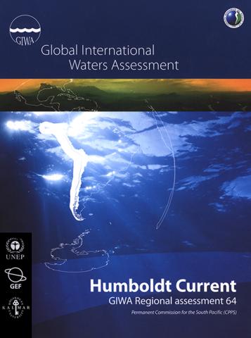
Humboldt Current
This report presents the GIWA assessment of the Humboldt Current region. The world’s largest upwelling area, supporting highly productive fisheries, is located within the boundaries of the region. The...
This report presents the GIWA assessment of the Humboldt Current region. The world’s largest upwelling area, supporting highly productive fisheries, is located within the boundaries of the region. The...
Global International Waters Assessment
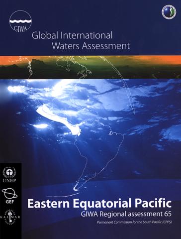
Eastern Equatorial Pacific
This report presents the assessment of the GIWA Eastern Equatorial Pacific region, which includes parts of Mexico, Guatemala, Honduras, Nicaragua, Costa Rica, Panama and Colombia. Pollution in the...
This report presents the assessment of the GIWA Eastern Equatorial Pacific region, which includes parts of Mexico, Guatemala, Honduras, Nicaragua, Costa Rica, Panama and Colombia. Pollution in the...
Global International Waters Assessment
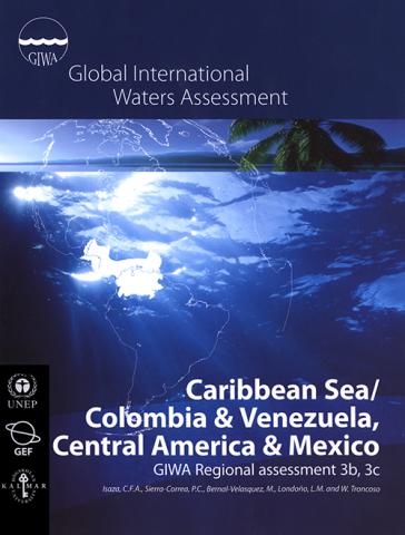
Caribbean Sea/Colombia & Venezuela, Central America & Mexico
This report presents the results of the GIWA assessment of the Colombia & Venezuela and Central America & Mexico sub-systems. In the Colombia & Venezuela sub-system, coastal habitats are being...
This report presents the results of the GIWA assessment of the Colombia & Venezuela and Central America & Mexico sub-systems. In the Colombia & Venezuela sub-system, coastal habitats are being...
UNECE Countries in Figures 2017
UNECE Countries in Figures presents a profile of social and economic indicators for each of the 56 UNECE member countries. These profiles, prepared by the UNECE Statistical Division, are intended to...
UNECE Countries in Figures presents a profile of social and economic indicators for each of the 56 UNECE member countries. These profiles, prepared by the UNECE Statistical Division, are intended to...
UNECE Countries in Figures 2019
This publication presents a profile of social and economic indicators for each of the 56 UNECE Member States. These profiles, prepared by the Commission's Statistical Division, are intended to be of...
This publication presents a profile of social and economic indicators for each of the 56 UNECE Member States. These profiles, prepared by the Commission's Statistical Division, are intended to be of...
Global International Waters Assessment
Barents Sea
This report presents the results of the GIWA assessment of the Barents Sea region – one of the largest shallow continental shelf seas in the world and the most productive sea within the Arctic Ocean...
This report presents the results of the GIWA assessment of the Barents Sea region – one of the largest shallow continental shelf seas in the world and the most productive sea within the Arctic Ocean...
Global International Waters Assessment
Patagonian Shelf
This report presents the assessment of Patagonian Shelf and associated river basins. The report focuses on the La Plata River Basin, the second largest watershed in South America, and the South...
This report presents the assessment of Patagonian Shelf and associated river basins. The report focuses on the La Plata River Basin, the second largest watershed in South America, and the South...
Global International Waters Assessment
Brazil Current
This report presents the assessment of the GIWA region Brazil Current. Increased anthropogenic pressures due to economic development and urbanisation in the coastal area have polluted the water...
This report presents the assessment of the GIWA region Brazil Current. Increased anthropogenic pressures due to economic development and urbanisation in the coastal area have polluted the water...
Global International Waters Assessment
Amazon Basin
This report presents the assessment of the Amazon Basin – the largest basin on the planet and also one of the least understood. Although sparsely inhabited, the Basin is subject to extensive...
This report presents the assessment of the Amazon Basin – the largest basin on the planet and also one of the least understood. Although sparsely inhabited, the Basin is subject to extensive...
Global International Waters Assessment
Lake Chad Basin
This report represents the GIWA Assessment of the Lake Chad Basin, which is located in one of the poorest and most drought prone regions in the world. Climatic variability and poor water governance...
This report represents the GIWA Assessment of the Lake Chad Basin, which is located in one of the poorest and most drought prone regions in the world. Climatic variability and poor water governance...
Global International Waters Assessment
Indian Ocean Islands
This report presents the assessment of the Indian Ocean Islands, one of two oceanic assessments conducted by the GIWA. The region covers the Island States of Comoros, Mauritius, Madagascar and...
This report presents the assessment of the Indian Ocean Islands, one of two oceanic assessments conducted by the GIWA. The region covers the Island States of Comoros, Mauritius, Madagascar and...
Global International Waters Assessment
Caribbean Sea/Small Islands
This report presents the GIWA assessment of the Small Islands sub-system of the Caribbean Sea region. Habitat and community modification, as a result of anthropogenic pressures, was found to cause the...
This report presents the GIWA assessment of the Small Islands sub-system of the Caribbean Sea region. Habitat and community modification, as a result of anthropogenic pressures, was found to cause the...

Global International Waters Assessment
Caribbean Islands
This report presents the GIWA assessment of the Caribbean Islands region. A variety of human activities are impacting the region’s sensitive and unique ecosystems, upon which the population is so...
This report presents the GIWA assessment of the Caribbean Islands region. A variety of human activities are impacting the region’s sensitive and unique ecosystems, upon which the population is so...